- blog/
Goode Homolosine projection in QGIS
Step 1: download the following files from zenodo.org:1
CounterDomain.geojsonHomolosine.crs
Step 2: create a new custom projection with the proj string in Homolosine.crs
Step 3: create a new project and add CounterDomain.geojson as a layer
Step 4: change the project CRS to your new custom projection (it will have an “Authority ID” that looks something like USER:100003)
The CounterDomain polygon will disappear from the canvas…
Step 5: right-click the CounterDomain layer in the layers panel > Layer CRS > Set to USER:100003
The CounterDomain polygon will reappear on the canvas!
Step 6: save your project
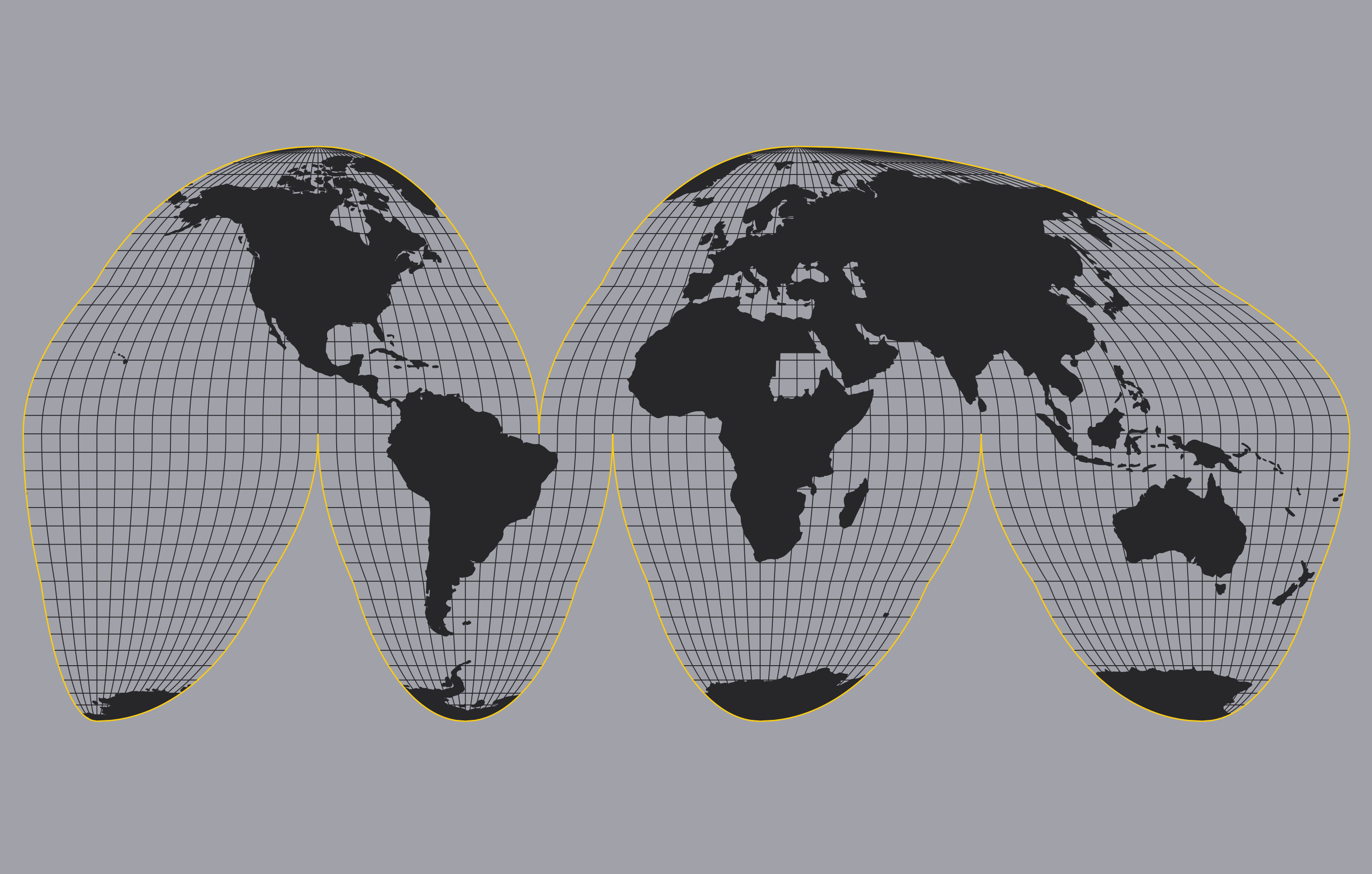
Step 7: add whatever layer you want to try and portray with the Goode Homolosine projection, for example Natural Earth’s ne_110m_admin_0_countries 2
It will appear on the canvas, with Antarctica and Greenland stretched across the interruptions…
Step 8: reproject ne_110m_admin_0_countries to the custom Homolosine projection
- right-click the layer in the layers panel > Export > Save Features As…
- select your desired format, and remember to actually reproject it…
- …by changing the “CRS” field to the following:
Project CRS: USER:100003 - custom_Homolosine(or whatever name you gave it) - keep
Add saved file to mapchecked, and once you click OK you’ll see that…
…Antarctica and Greenland are still stretched across the interruptions?
This is fine. You haven’t intersected things yet.
Step 9: right-click the new layer > Layer CRS > Set to USER:100003
Step 10: now open the Intersection tool from Processing Toolbox > Vector overlay
- the new countries layer should be the Input Layer
- the CounterDomain layer should be the Overlay layer
- click Run
You’ll get an error with 2 of the features in the ne_110m_admin_0_countries layer:
Feature (15) from “homolosine_ne_110m_admin_0_countries” has invalid geometry and has been skipped. Please fix the geometry or change the Processing setting to the “Ignore invalid input features” option.
Feature (73) from “homolosine_ne_110m_admin_0_countries” has invalid geometry and has been skipped. Please fix the geometry or change the Processing setting to the “Ignore invalid input features” option.
You can overcome this by setting the Input layer settings for “Invalid feature filtering” to “Skip (Ignore) Features with Invalid Geometries” and then it’ll finish running.
But you’ll notice 2 missing countries in Africa: Sudan and Mozambique
Shrug. I don’t know why these 2 features have an issue, but you can extract them into their own layer, then merge that layer with your intersection and tada!
It does say that “this polygon can be used to portray oceans” after all.
If you try all this with a Natural Earth ocean polygon then it will indeed complete without errors. It also works well with Natural Earth graticules.
-
zenodo.org link via https://gis.stackexchange.com/questions/17263/is-it-possible-to-use-the-goode-homolosine-projection-in-qgis/309395#309395 and Luís de Sousa who created it ↩︎
-
which can be downloaded from here: https://www.naturalearthdata.com/downloads/110m-cultural-vectors/ ↩︎